
Rand McNally Unveils 2027 Motor Carriers’ Road Atlas, Affirming Print’s Indispensable Role in Commercial Navigation
Defying prognoses of print’s demise in an increasingly digital world, Rand McNally Publishing today announced the official release of the 2027 edition of its critically acclaimed Motor Carriers’ Road Atlas. This annual publication, a cornerstone for professional commercial truck drivers since its inaugural release in 1982, continues to serve as an indispensable navigation tool, meticulously updated to meet the complex demands of modern freight transportation across North America. The launch underscores the enduring value of specialized physical maps, particularly within sectors where precision, reliability, and robust backup solutions are paramount.
The Enduring Relevance of Print in a Digital Age
In an era dominated by GPS devices, smartphone applications, and in-cab telematics systems, the persistent demand for a physical road atlas might appear anachronistic to some. However, for the millions of professional truck drivers traversing the intricate network of highways and byways, the Motor Carriers’ Road Atlas remains a vital component of their operational toolkit. The publisher emphasized that this freshly updated guide offers critical, truck-specific navigation tools that digital maps and standard consumer-grade GPS platforms frequently lack. These deficiencies often include accurate bridge height restrictions, weight limits, designated hazardous materials (HAZMAT) routes, and specific commercial vehicle restrictions, all of which are crucial for safe and compliant operations.
The trucking industry, a linchpin of the global economy, is characterized by its reliance on precise routing and adherence to stringent federal and state regulations. According to the American Trucking Associations (ATA), trucks move approximately 72.5% of all freight in the U.S. by weight, translating to over 11.5 billion tons of goods annually. This immense volume of commerce is facilitated by roughly 3.5 million professional truck drivers. For these drivers, inaccurate navigation can lead to costly delays, fines, and, most critically, dangerous situations such as bridge strikes or illegal routing through residential areas. The atlas is specifically "built for long-haulers," designed to address these unique challenges head-on.
Key Features of the 2027 Edition
The 2027 Motor Carriers’ Road Atlas is not merely a collection of maps; it is a comprehensive operational guide. Its core utility lies in providing an essential trip planner, allowing drivers and dispatchers to pre-plan routes that account for truck-specific parameters, optimize fuel stops, and comply with Hours of Service (HOS) regulations. Beyond its primary function, it also serves as a dependable physical backup during unexpected digital signal drops, system failures, or areas with poor cellular coverage—a common occurrence in vast stretches of the continent.
A spokesperson for Rand McNally, speaking on the release, highlighted the company’s unwavering commitment to the professional driver. "While technology continues to advance, the fundamental needs of a commercial driver for accurate, reliable, and truck-specific information remain constant. The 2027 Motor Carriers’ Road Atlas embodies our dedication to safety and efficiency, providing a robust solution that complements digital tools and offers unparalleled peace of mind."
Prioritizing Safety and Compliance
Safety remains the paramount focus of the atlas. Beyond broad national route coverage, the 2027 edition is packed with meticulously updated regulatory information. This includes, but is not limited to, the precise locations and specifications of low clearances (bridges, tunnels, overhead power lines), designated routes for hazardous materials, and the critical locations of weigh stations and inspection facilities across the U.S. and Canada. The inclusion of HAZMAT routes is particularly vital, as transporting dangerous goods requires strict adherence to federal regulations, often dictating specific highways or avoiding certain urban areas. Errors in HAZMAT routing can result in severe penalties, environmental hazards, and public safety risks.
Furthermore, the atlas features a massive 22-page city-to-city mileage directory. This invaluable resource allows drivers to quickly calculate distances between major hubs, aiding in fuel planning, adherence to HOS rules, and accurate billing. For a driver operating under tight schedules and strict regulations, knowing precise distances is crucial for effective time management and operational efficiency.
Domestic Production: A Commitment to Quality and Economy
In a significant affirmation of its commitment to quality and domestic industry, Rand McNally proudly stated that the 2027 Motor Carriers’ Road Atlas was developed and printed entirely within the United States. This commitment to domestic production not only supports American jobs but also allows for stringent quality control throughout the entire production process, from cartography to printing and binding. For a product where accuracy and durability are critical, maintaining tight control over manufacturing is a distinct advantage. It also reflects a broader corporate philosophy that resonates with many in the U.S. trucking industry, which itself forms a backbone of the national economy.
Concrete Road Changes Reflected in the 2027 Edition
The continuous evolution of national infrastructure necessitates constant updates to navigation tools. The 2027 atlas meticulously documents concrete road changes throughout the country, ensuring drivers have the most current information available. Notable updates in this edition include new interstate designations in Oklahoma, reflecting ongoing highway expansion and reclassification projects aimed at improving connectivity and traffic flow within the state. For instance, recent re-designations and expansions of routes around major metropolitan areas like Oklahoma City and Tulsa would be precisely detailed. Additionally, a recently completed loop in North Carolina, likely referring to significant bypasses or beltways around cities such as Charlotte or Raleigh, is clearly mapped. Such infrastructure developments can dramatically impact routing efficiency and driver safety, making their accurate depiction essential.
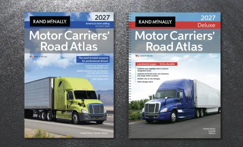
Drivers can acquire the 2027 Motor Carriers’ Road Atlas in several convenient formats tailored to various preferences and needs. These include a traditional paperback version, a more durable laminated spiral-bound deluxe format designed for heavy use in the cab, and a large-scale version boasting 37 percent larger maps for enhanced readability, especially beneficial for drivers with limited space or those who prefer larger print. The atlas is available right now at major truck stops across the nation, general bookstores, and through a wide array of online retailers, ensuring broad accessibility for professional drivers.
A Legacy of Navigation: The Atlas’s History
The inception of the Motor Carriers’ Road Atlas in 1982 was a direct response to a critical, unmet need within the burgeoning commercial trucking industry. Rand McNally, with its rich history dating back to 1856 as a printer of railroad tickets and later a pioneer in road mapping, identified a significant gap in available navigation tools. Prior to 1982, professional truck drivers were largely reliant on standard consumer maps, which, while useful for passenger vehicles, were woefully inadequate for the unique requirements of commercial vehicles.
Standard road maps are designed to show the shortest path from point A to point B, often prioritizing efficiency for cars and light trucks. They do not, however, account for the physical constraints of a semi-truck—its height, weight, length, and width—nor do they consider regulatory restrictions such as truck routes, bridge weight limits, or HAZMAT prohibitions. The deregulation of the trucking industry in the late 1970s and early 1980s led to an explosion in interstate commerce and a corresponding increase in the complexity of logistics. Rand McNally stepped in to fill this critical gap, creating a specialized atlas that quickly became the industry standard.
Over the past four decades, the Motor Carriers’ Road Atlas has evolved significantly, adapting to changes in infrastructure, technology, and regulations. Each annual edition represents thousands of hours of cartographic research, data verification, and collaboration with industry experts and drivers themselves. This iterative process ensures that the atlas remains the most comprehensive and accurate physical navigation tool available for commercial transport.
The Digital Age and the Physical Backup
While digital navigation tools offer undeniable advantages in real-time traffic updates and dynamic rerouting, they are not without their limitations. Instances of commercial vehicles getting stuck under low bridges or routed onto restricted roads due to generic GPS data are well-documented. A 2018 study by the American Transportation Research Institute (ATRI) highlighted that navigation errors, often stemming from non-commercial GPS systems, contribute to significant operational inefficiencies and safety risks for truckers. This underscores why many experienced drivers continue to value a physical atlas as a primary planning tool and an essential fail-safe.
"You can’t lose a signal with a paper map," commented a veteran truck driver, John M. from Texas, who has relied on Rand McNally atlases for over 30 years. "I plan my routes with the atlas, then cross-reference with my GPS. If the GPS tries to take me somewhere sketchy, I trust the atlas. It’s saved me from countless headaches and potential fines." This sentiment is widely echoed across the industry, highlighting the symbiotic relationship between traditional and modern navigation methods.
Broader Implications for the Trucking Sector
The continued success and annual release of the Motor Carriers’ Road Atlas carry several broader implications for the commercial trucking sector and the economy at large. Firstly, it reinforces the emphasis on safety. By providing drivers with meticulously verified, truck-specific data, the atlas directly contributes to reducing accidents, avoiding regulatory violations, and enhancing overall road safety for both commercial and passenger vehicles.
Secondly, it promotes efficiency. Optimized routing, based on accurate information about truck-legal roads and facilities, leads to reduced fuel consumption, shorter transit times, and improved on-time delivery rates. This efficiency translates into cost savings for trucking companies and ultimately lower prices for consumers.
Finally, the atlas serves as a symbol of the industry’s resilience and its ability to integrate traditional methods with technological advancements. It stands as a testament to the enduring human element in an increasingly automated field, where the judgment and preparedness of the driver remain paramount. As the trucking industry continues to innovate, the Rand McNally Motor Carriers’ Road Atlas will likely continue its evolution, reflecting infrastructure changes and regulatory updates, and remaining an indispensable companion for the professional men and women who keep the nation’s economy moving. Its 2027 edition solidifies its position not just as a map, but as an integral piece of the operational infrastructure for commercial transport.


